Wild South Coast Way on the Heysen Trail
More information
Click the button below to view more information.
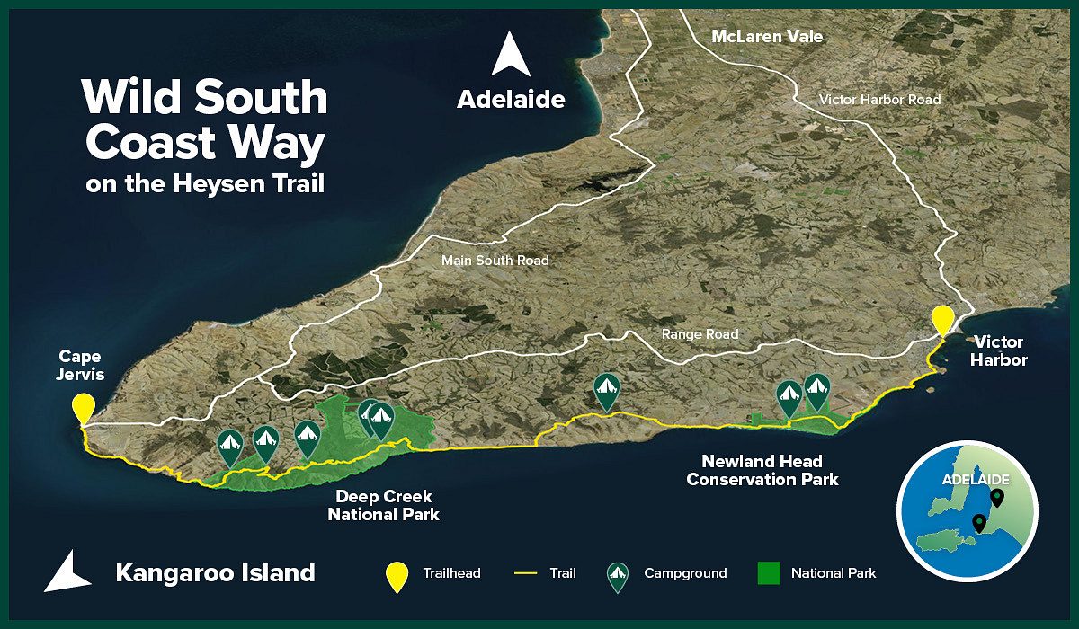
The Wild South Coast Way on the Heysen Trail (WSCW) is a fully customisable, multi-day walking experience between Cape Jervis and Victor Harbor on the Fleurieu Peninsula, South Australia.
Walk the Wild South Coast Way your own way – any day, any direction, any section. From day visits with short loop walks to the full five-day four-night experience and everything in between, the WSCW allows walkers to choose their own adventure.
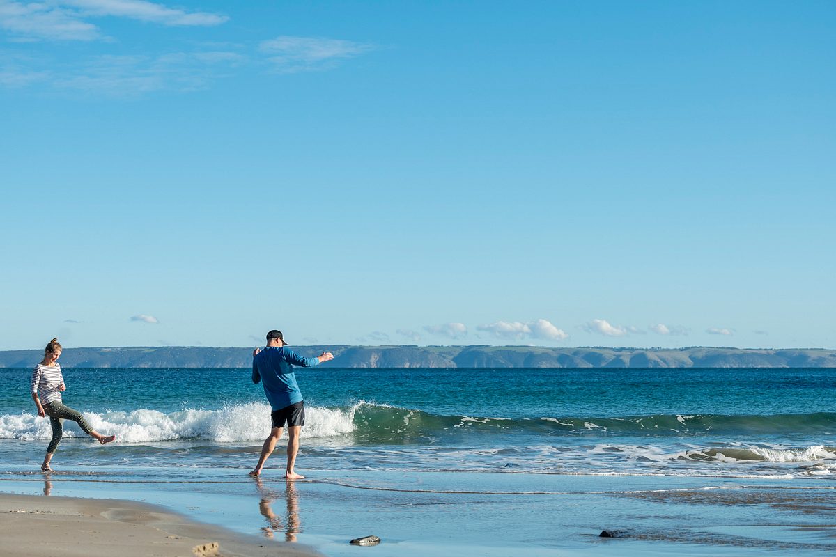
The walking experience offers some of the state’s most spectacular and awe-inspiring coastal walking imaginable. The WSCW provides visitors a genuine sense of wilderness, featuring remote beaches, native bushland, rugged cliffs, First Nations’ history, breathtaking vistas, deep gullies and a rich diversity of native birds, bush and wildlife, in fact more species than anywhere else on the coast.
Each day of the walk delivers a new experience and challenge, starting with views across to Kangaroo Island before the full nature experience begins, encouraging the walker to ‘tune in’ to nature and ‘tune out’ of stress.
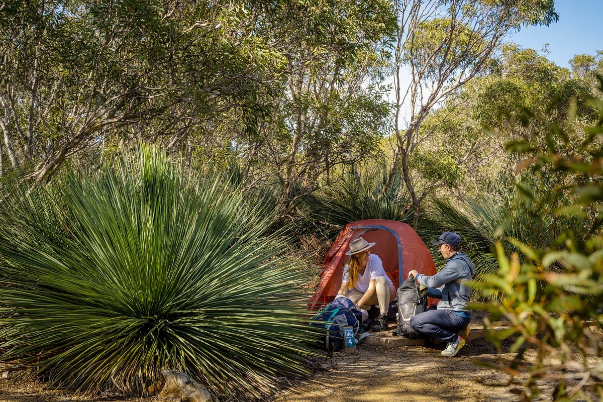
The trail connects the parks along our breathtaking southern coastline from Cape Jervis to Victor Harbor including Deep Creek National Park, Ballaparudda Creek Recreation Park and Newland Head Conservation Park. If doing a multi-day walk, camp at one of the park campgrounds along the way: there are four walk-in only campgrounds and four drive-in campgrounds on or near the trail.
The Wild South Coast Way on the Heysen Trail has been supported by the South Australian Government through the National Parks and Wildlife Service and with project partners, Friends of the Heysen Trail, Yankalilla District Council and the City of Victor Harbor.
Open daily.
The Wild South Coast Way is open year round except on days of Catastrophic fire danger.
The parks that the Wild South Coast Way traverses are closed on days of Catastrophic Fire Danger and may also be closed on days of Extreme Fire Danger.
You can determine the current fire danger rating by checking the Fire Ban District map on the CFS website.
Check the CFS website or call the CFS Bushfire Information Hotline 1800362361 for:
- Information on fire bans and current fire conditions
- Current CFS warnings and incidents
- Information on what to do in the event of a fire.
Listen to your local area radio station for the latest updates and information on fire safety.
Visitor information and park management:
Deep Creek National Park Headquarters
Phone: (+618) 8598 0263
All camping booking enquiries
Victor Harbor National Parks and Wildlife Service Office
Phone: (+618) 85520300
Email: DEW.FleurieuOnlineBookings@sa.gov.au
Emergency contacts:
Medical, fire (including bushfire) and police emergency situations
Phone: Triple Zero (000)
Police Assistance
Phone: 131444 for non-urgent police assistance
National Parks and Wildlife Service SA – After-hours duty officer
Phone: 0427556676 (emergencies only)
Injured wildlife:
Within parks
Please contact Victor Harbor National Parks and Wildlife Service Office on (08) 85520300 or the after-hours duty officer on 0427556676 (outside of business hours).
Outside of parks
Please contact a local wildlife rescue group
Marine mammals
If you find a sick or stranded marine mammal (including whales, seals, sea lions and dolphins), please contact Victor Harbor National Parks and Wildlife Service Office on (08) 85520300 or the after-hours duty officer on 0427556676 (outside of business hours)
Every season on the Wild South Coast Way offers something different, so you’re sure to have an amazing experience whenever you visit. The Fleurieu Peninsula’s weather is variable year round and changes in temperature and conditions can occur suddenly and without much warning given the trail’s exposed location. You’re likely to experience a bit of everything on your walk – sunshine, wind and rain.
Spring (September — November): the season of rebirth and a wonderful time to see the spectacular array of wildflowers, reptiles, frogs, birds and butterflies galore. With sunny days and early mornings perfect for adventure and an ideal time to explore.
Summer (December – February): wildlife retreats to bushland habitat to shelter during the heat of the day, summer wildflowers and the new growth of native trees add colour to the landscape and cool sea breezes provide relief on hot days. Share early morning beach adventures with shorebirds and uncover natural treasures.
Autumn (March – May): a time of transition with modest rainfall bringing waterways back to life and providing new growth for wildlife to feed on and sea winds are calmer. Sea treasures are washed ashore.
Winter (June – August): orchids, moss and fungi are prolific, rivers are flowing, winter swells crash into towering cliffs providing a breathtaking spectacle, echidnas form ‘mating trains’ where up to eight males follow a female around, majestic southern right whales pass the shores and high rainfall produces lush, green vegetation.
The Wild South Coast Way on the Heysen Trail is located on the Fleurieu Peninsula, between Cape Jervis and Victor Harbor. The trail can be accessed from multiple points. The following access points can be reached by vehicles and have car parking:
|
Parks are for all to enjoy, we would love to hear from you about your experience in nature. You can share your comments, pictures and videos with us and others by tagging @NationalParksSA on Facebook, Instagram or email us.
Facilities
Parking
There are two accessible parking spaces at Goondooloo picnic area.
Toilets
There are accessible toilets at the Goondooloo Picnic Area (Deep Creek National Park), Waitpinga Beach (Newland Head National Park) and Muwerang Kent Reserve in Victor Harbor.
Trails
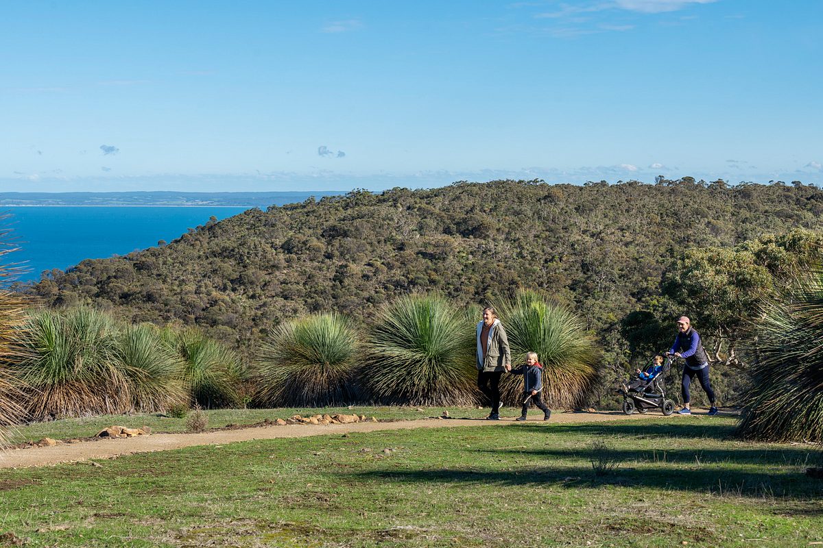
The 4.2 km return Goondooloo Ridge Walk is a spur trail off the main Wild South Coast Way trail and has a hard packed surface, about 1 m wide, and slopes gently down towards the Goondooloo Lookout. The lookout offers spectacular views across Backstairs Passage and The Pages island group to Kangaroo Island. The walk is a Class 2 trail so some people may require assistance. The trail is suitable for prams.
Staying near the trail
Camping
There are accessible campsites (No 12 and No 13) available at Stringybark Campground in Deep Creek National Park. This campground is not located on the trail, but is a short drive away. For more information please contact Deep Creek National Park Headquarters on (+618) 85980263.
Accommodation
Southern Ocean Retreats offers fully compliant wheelchair friendly accommodation at one of their Ridgetop Retreats in Deep Creek National Park.
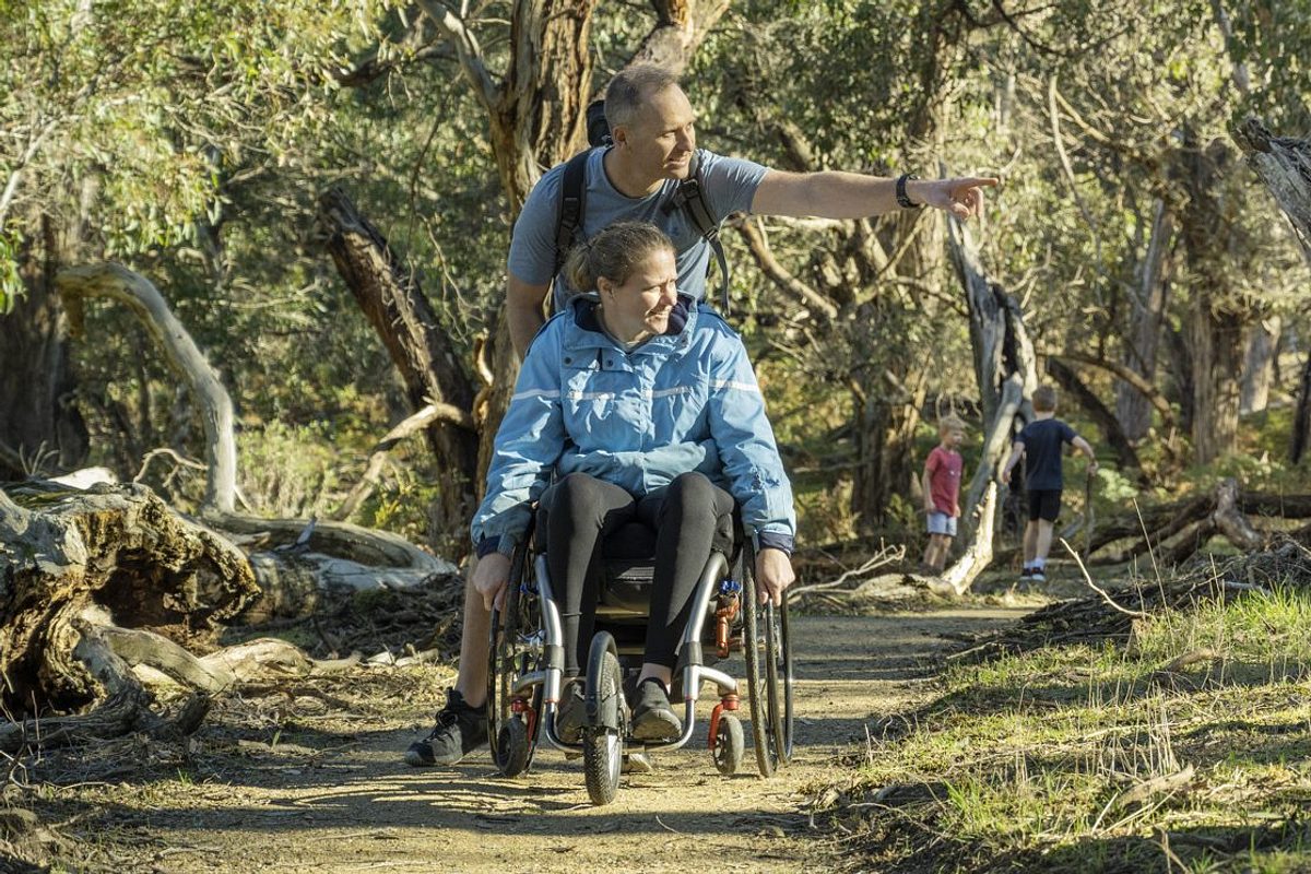
The TrailRider all-terrain wheelchair allows people with limited mobility to explore the diverse trails. The one-wheeled chair is a cross between a wheelbarrow and sedan chair. The TrailRider requires a minimum of two reasonably fit people (one at each end of the chair).
The District Council of Yankalilla have a TrailRider wheelchair available for free hire for up to three days. Chair users are required to bring a bike helmet and undertake a chair induction via short video prior to use. It weighs 25kg, but can easily disassemble and fit in the back of most medium sized SUVs.
The TrailRider can be used on a number of different walking trails and in a variety of locations, including along the Wild South Coast Way. You will need two or four fit helpers, depending on the trails you wish to travel and the strength and level of fitness of your helpers. The chair is motorised, making it easier to explore some steeper and longer trails.
Deep Creek TrailRider suggested routes
Goondooloo Ridge – (Beginner, 4.1 km and 68 m ascent) An easy route along a wide trail which gives a good introduction to operating the TrailRider. The trail descends and steepens slightly. The route finishes at a spectacular lookout with picnic tables. Return to the start by the same route.
Goondooloo Picnic Area to Eagle Waterhole – (Advanced, 4.4 km and 125 m ascent). The first 1.5 km gradually descends on a hard packed trail before steeper sections and loose surfaces to Eagle Waterhole which provides a good lunch stop. Return to the start by the same route, don’t be daunted by the ascent as the motor on the TrailRider makes light work of it.
Boat Harbor – (Highly advanced, 6.8 km and 160 m ascent) Starting from The Pages Lookout car park the compact trail gradually descends towards Boat Harbor. This is a narrow trail but gives few technical difficulties apart from a couple of small rock steps. Although longer with slightly more ascent it makes for an adventurous excursion.
TrailRider grades
To complement the Australian Walking Track Grading System (AWTGS), Parks Victoria have developed a TrailRider Track Grading System (TTGS) for motorised TrailRiders. This system is independent of the AWTGS and focuses on the number, skill and fitness of TrailRider operators. Users of a TrailRider are encouraged to consider both the AWTGS and the TTGS when selecting a track. One or more additional operators are recommended for non motorised TrailRiders.
Beginner Operators
Suitable for all skill levels, including those with no or limited experience. Tracks are typically flat or undulating with gentle hills and limited obstacles. Suitable for most fitness levels. Two to three operators.
Intermediate Operators
Suitable for people with experience on undulating trails. Some obstacles, short staircases with wide landings and occasional sharp bends. A moderate level of fitness is required. Three to four operators.
Advanced Operators
Suitable for people with experience on uneven trail surfaces. Operators may encounter short steep hills, narrow sections, staircases and many sharp bends. A high level of fitness is required. Three to four operators.
Highly Advanced Operators
Suitable for people with extensive experience using a TrailRider on uneven trail surfaces. Long steep and difficult hills, rough and unformed surface with many steps, obstacles and sharp bends. A high level of fitness with strong upper body strength is required. May require navigational skills in bushwalking. Four operators minimum recommended.
Free TrailRider hire
Bookings are essential to avoid disappointment. To book contact:
Fleurieu Coast Visitor Information Centre
163 Main South Road, Yankalilla SA5203
Phone: 0885580240 or 1300965842
Email: cooee@visitfleurieucoast.com.au
Dogs are not permitted in Deep Creek National Park, Ballaparudda Creek Recreation Park and Newland Head Conservation Park.
There is a variety of facilities available along the Wild South Coast Way on the Heysen Trail.
Toilets are located at all campgrounds, and at Cape Jervis (accessible), Goondooloo picnic area (accessible), Parsons Beach, Waitpinga Beach (accessible) and Muwerang Kent Reserve in Victor Harbor (accessible).
Picnic tables are available at various locations within Deep Creek National Park (Goondooloo picnic area, Goondooloo Lookout, Cobbler Hill picnic area, Trig campground and Tapanappa Lookout), at Waitpinga Campground in Newland Head Conservation Park, and at Muwerang Kent Reserve in Victor Harbor.
Fire pits are located at the following campgrounds in Deep Creek National Park: Cobbler Hill, Trig and Tapanappa (seasonal fire restrictions apply).
BBQ facilities are located at Waitpinga Campground in Newland Head Conservation Park and Muwerang Kent Reserve in Victor Harbor.
Assistance dogs are permitted in most public places and are therefore welcome in South Australia’s parks and reserves. Assistance dogs must be appropriately restrained on a lead and remain under your effective control at all times while in a park or reserve.
As per the dogs in parks and reserves policy, if the dog is not an accredited assistance dog, they must be trained to assist a person with a disability to alleviate that disability and meet standards of hygiene and behaviour appropriate for a dog in a public place. However, refusal may be given if the person with the disability is unable to produce evidence the dog is an assistance dog with the appropriate training.
Before taking your assistance dog into a park that does not normally allow dogs, it is highly recommended that you contact us so we can provide you with the latest information on any potential hazards within specific parks that may affect your dog. Please contact the park via the contact details provided under the contact tab or contact the visitor service centre via email or on Facebook.
- Check out The Friends of the Heysen Trail website for detailed information on the Wild South Coast Way including distances, access points, and accommodation, transport and service providers.
- Check out Your guide to the new family-friendly trail in Deep Creek National Park on the Good Living blog.
- Check out Deep Creek from a drone on the Good Living blog.
- Check out Nature Play SA’s 40 things to do in Deep Creek National Park.
- Discover 10 things to see and do at Deep Creek on the Good Living blog.
- Explore what other nature and outdoor activities are available in this area on the South Australia Tourism website.
- Mobile phone coverage can be patchy and unreliable in this park, especially if you are in low-lying areas.
- Important: Collection of firewood within national parks and along roadsides is prohibited. Dead wood plays a vital role in providing shelter for animals and adding nutrients to the soil.
Phytophthora (fy-TOFF-thora), otherwise known as root-rot fungus, is killing our native plants and threatens the survival of animals depending on plants for food and shelter.
This introduced fungus can be found in plant roots, soil and water. Help stop the spread by using hygiene stations, cleaning walking equipment, staying on tracks and trails and by complying with all Phytophthora management signs.
The Wild South Coast Way traverses Ramindjeri Ruwi (land), with connections to Kaurna Country at Cape Jervis. Ramindjeri are one of eighteen Lankinyerar (tribes) of the Ngarrindjeri Nation, whose Country spans the lower River Murray, Coorong and western Fleurieu Peninsula.
The trail retraces the final footsteps of an ancient ancestor named Ngurunderi, who is said to have shaped the landscapes, spiritual identities and cultural traditions of the Ngarrindjeri palak (people).
In Ngurunderi’s footsteps, the Ramindjeri palak followed – Caring for Country according to the laws and customary rights and obligations he gave to them.
Ramindjeri palak continue to play an active role in caring for their Country, including in the parks along the Wild South Coast Way.
There are many places along the trail that have great spiritual significance to Ramindjeri palak.
Please show respect when visiting this special part of Country by taking only photographs and leaving only footprints.
Aboriginal peoples continue to play an active role in caring for their Country, including in parks across South Australia.
Walk the Wild South Coast Way your own way – any day, any direction, any section. From short loop walks to the full five-day four-night experience and everything in between, the WSCW allows walkers to choose their own adventure.
The sections of the WSCW range in level of difficulty. Walking tracks in National Parks SA reserves are graded according to the Australian Walking Track Grading System. Check the grade to help you work out if a walk will suit your level of fitness and experience.
Grade 1 walk
Kondoli — Keeper of Fire Walk (30 minutes, 450 m)
Discover how Ramindjeri people came about the tools to create fire and take in panoramic coastal views from Tapanappa Lookout. This Grade 1 trail is suitable for visitors of all ages including families with young children, people with mobility issues and the elderly. The trail includes several spots to sit and take in the views, as well as undercover picnic areas.
Grade 2 walks
Goondooloo Ridge Walk (2 hours, 4 km)
This trail along Goondooloo Ridge offers spectacular views of Backstairs Passage and the Pages Islands. Visitors will walk through re-vegetated and remnant native bushland to a lookout with spectacular views. Along the way large mobs of kangaroos can be seen grazing in the open fields or resting under eucalypts. This Grade 2 trail is suitable for visitors of all ages including families with young children and the elderly.
Grade 3 walks
Cape Jervis — Fishery Beach (2 hours, 4.4 km)
Follow the coast along rocky beaches with stunning coastal views towards Kangaroo Island and meander through low vegetation rich with butterflies on this easy walk. As the name suggests, Fishery Beach is a popular fishing area.
Grade 4 walks
Marrano Creek Hike (Half day, 6.7 km)
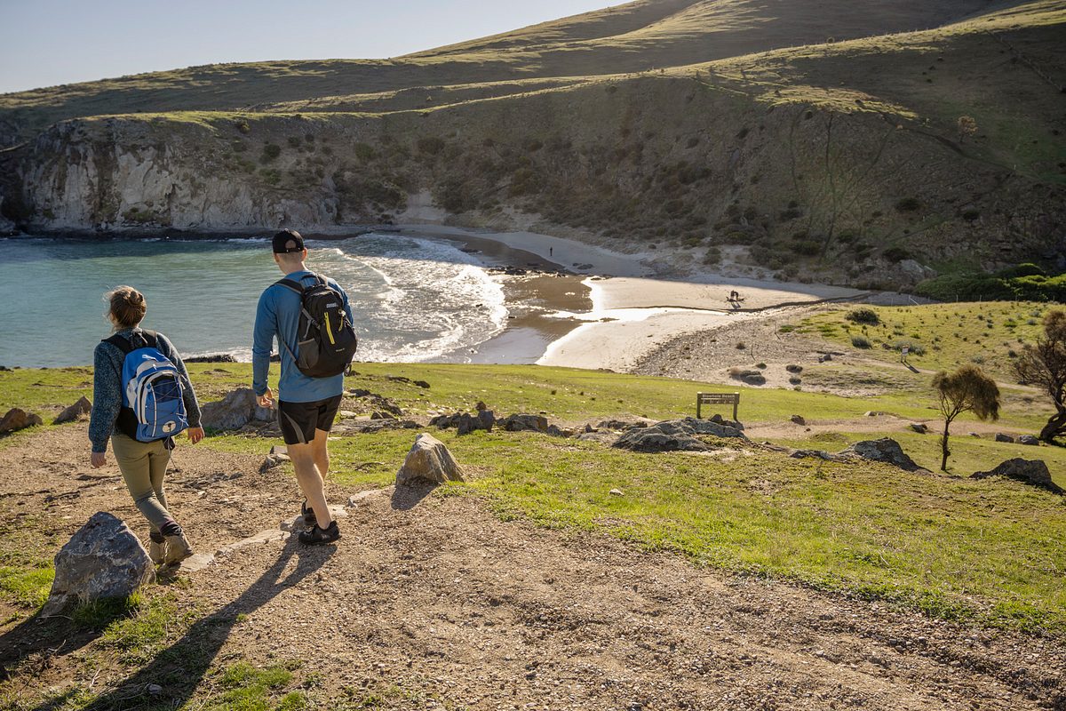
Enjoy excellent views of Kangaroo Island and The Pages Islands on this challenging loop trail, which traverses windy grasslands and coastal scrub. Follow Blowhole Beach Hike down to the beach, before joining the Wild South Coast Way on the Heysen Trail and following it east to Cobbler Hill Campground and Marrano Creek. This terrain is steep and may be slippery – be prepared with adequate footwear. The trail starts from Cobbler Hill Picnic Area or Cobbler Hill Campground.
Deep Creek Waterfall Hike from Tapanappa Lookout (Half day, 7 km)
As you hike down into the valley along a section of the Wild South Coast Way on the Heysen Trail, you will journey through dense sheoak forests with rugged terrain. Along the way, you will be rewarded with excellent views of Deep Creek and a peaceful pit stop at Deep Creek Waterfall. A challenging hike for fit and experienced walkers. You can also start from Tapanappa Campground (add an extra 3 km return).
Boat Harbour Hike (Half day, 7.3 km)
Taking in part of the Wild South Coast Way on the Heysen Trail, this unique hike has breathtaking views of Kangaroo Island, The Pages Islands and Tunkalilla Beach. Those prepared for a steep trail and rock scramble can take a short diversion off the circuit trail to Boat Harbor Beach, a rocky cove where Boat Harbor Creek enters the Southern Ocean. The trail begins on Tapanappa Ridge. Follow the road towards Tapanappa Campground and turn to the ridge on your left before reaching the campground. This hike does not start at Tapanappa Lookout.
Waitpinga Beach — Waitpinga Cliffs (Half day, 8 km)
The best of both worlds – witness the powerful Southern Ocean up close as you traverse Waitpinga Beach before heading inland and then back out towards the towering Waitpinga Cliffs.
Newland Head Conservation Park Coastal Cliff Loop Hike (Half day, 8.6 km)
Spectacular coastal views from rolling hills and steep clifftops, watch for white-bellied sea-eagles on the way.
King Head to Waitpinga Beach (Half day, 12 km)
The walk from King Head to Waitpinga Beach within Newland Head Conservation Park is the spectacular highlight of the Heysen Trail. The focal point of this walk is again Waitpinga Cliffs. The trail follows along rolling hills and coastal scrub to the long Waitpinga Beach, a popular surfing and fishing spot. The walk includes panoramic views of Waitpinga Creek, Encounter Bay, the Pages in Backstairs Passage and Kangaroo Island.
Victor Harbor to Waitpinga Cliffs (Half day, 14 km)
The magnificent walk starts at the Bluff (Rosetta Head) passes Petrel Cove and follows the Victor Harbor Heritage Trail onto Kings Beach and then past King Head. The highlight of this walk is no doubt the Waitpinga Cliffs rising up 100 metres above the sea, one of SA’s most photographed coastal icons and an area frequented by the magnificent white-bellied sea-eagle. During May to October walkers may find southern right whales with calves.
Waitpinga Beach — Victor Harbor (Full day, 19 km)
From the popular surf beach, ascend towards Ridgeway Hill before heading out to the coastal cliffs, passing sea-eagle nesting areas and the spectacular cliffs of Newland Head. Past the cliffs, the trail emerges onto Kings Beach. The main Heysen Trail turns north here, but a spur trail continues along the coast on the Victor Harbor Heritage Trail, past Petrel Cove to The Bluff, continuing past Whalers Way along the esplanade at Encounter Bay to Kent Reserve.
Ballaparudda Creek to Victor Harbor (2 days, 29 km)
This section of the walk includes numerous highlights including one of the most iconic landscapes in South Australia, the Waitpinga Cliffs rising up 100 metres from the sea. Walkers will get to enjoy two magnificent beaches, namely Parsons Beach and Waitpinga Beach, spectacular views from the cliff tops towards Encounter Bay, The Bluff, Victor Harbor and Granite Island, and plentiful wildlife in the wild.
Grade 5 walks
Deep Creek Cove Hike from Tapanappa Lookout (2.5 hours, 3.4 km)
A rugged coastal hike through steep terrain and dense vegetation with spectacular views of Deep Creek. Be prepared to scramble over rocks on your way down to this secluded cove. Suitable for experienced and fit bushwalkers, this hike includes steep terrain and may be slippery. Be prepared to take your time and wear adequate footwear for extra grip. It can also be started from Tapanappa Campground (add 3 km return).
Deep Creek Circuit Hike (Full day, 10.9 km)
This hike offers some of the best landscape and ocean views in the park – it is also the most challenging. The trail is best taken in a clockwise direction from Trig Picnic Area, leading you to the waterfall and down into Deep Creek Cove. Deep Creek can be difficult to cross, and it is recommended not to cross when flooded. This hike is suited to experienced, fit walkers. The trail can be started from Trig Picnic Area or from Tapanappa Lookout.
Cobbler Hill Campground — Tapanappa (Full day, 13 km)
A challenging full day hike that traverses the two major valleys of Deep Creek National Park, it also includes some of the most spectacular sights. From ocean views and scrubland to waterfalls and fern-filled gullies, this section provides a diverse hiking experience. This hike is suited to experienced, fit walkers.
Cape Jervis to Tapanappa (2 days, 28 km)
The walk features the start of the coastal trail with amazing views to Kangaroo Island, Investigator Strait, and native bushland within Deep Creek National Park. It also includes the magnificent Blowhole Beach, the UFO house, Fishery Beach, First Nations’ history, spectacular valleys of Deep Creek, and plentiful wildlife in the wild.
Wild South Coast Way on the Heysen Trail — Cape Jervis to Victor Harbor (5 days, 74 km)
The hallmark five-day four-night walking experience from Cape Jervis to Victor Harbor can be walked in either direction. The trail offers some of the state’s most spectacular and awe-inspiring coastal walking imaginable. The WSCW provides a genuine sense of wilderness, featuring remote beaches, native bushland, rugged cliffs, First Nations’ history, breathtaking vistas, deep gullies and a rich diversity of native birds, bush and wildlife.
The five sections are summarised below. Most of the sections offer both a vehicle-based and walk-in only camping option.
Cape Jervis to Eagle Waterhole (Full day, 16 km)
A mostly coastal trail with amazing views to Kangaroo Island, Investigator Strait, and native bushland within Deep Creek. It also includes the magnificent Blowhole Beach, the quirky UFO house, Fishery Beach, First Nations’ history, spectacular valleys of Deep Creek, and plentiful wildlife in the wild. Camp at Cobbler Hill Campground (vehicle-based) or Wuldi Krikin Ngawanthi (Eagle Waterhole Campground) (walk-in only).
Eagle Waterhole Campground to Tapanappa (Full day, 12 km)
A challenging hike that traverses the two major valleys of Deep Creek, it also includes some of the most spectacular sights. From ocean views and scrubland to waterfalls and fern-filled gullies, this section provides a diverse hiking experience. This hike is suited to experienced, fit walkers. Camp at Tapanappa Campground (vehicle-based) or Yapari Ngawanthi (Cliffs Campground) (walk-in only).
Tapanappa to Ballaparudda Creek (Full day, 18 km)
A picturesque section highlighting the diversity of the trail, traverse native bushland, the long sandy Tunkalilla Beach, lush farmland and some very memorable hills. Breathtaking views of Kangaroo Island and The Pages Islands. Camp at Kurri Ngawanthi (Creek Campground).
Ballaparudda Creek to Newland Head (Full day, 13 km)
A mix of inland and coastal walking, this section showcases picturesque farmland, rocky headlands and two unspoilt sandy beaches. The wild waves of Parsons Beach and Waitpinga Beach make Newland Head Conservation Park a surfer’s paradise. Camp at Waitpinga Campground (vehicle-based) or Natunyuru Ngawanthi (Sand Dunes Campground) (walk-in only).
Newland Head to Victor Harbor (Full day, 17 km)
The highlight of this walk is no doubt the Waitpinga Cliffs rising up 100 metres above the sea, one of SA’s most photographed coastal icons and an area frequented by the magnificent white-bellied sea-eagle. During May to October walkers may find southern right whales with calves.
The SA National Parks Tours App shares cultural stories of the area, information about things to see and helpful hints for those walking along the Wild South Coast Way. Hear from Ramindjeri elders and park rangers, identify plants and animals along the trail, and take part in guided meditations. Download the app before you depart on the App Store or Google Store.
Camping
Walk-in campgrounds
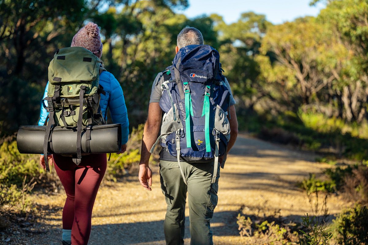
Four walk-in campgrounds are located along the Wild South Coast Way. Camping is only permitted in designated sites in campgrounds.
Fees apply and you must book in advance. Book before you go. If you are leaving a vehicle in Deep Creek National Park overnight, they may only be parked at day visitor areas.
Nearly all campsites are suitable for one hiking tent only. A very small number of sites can fit two one-person tents. Please check the campsite description carefully to ensure the site is suitable for your needs.
Campers using the timber platforms should be aware that pop-up anchors on the platforms and tie-downs along the edges of the platforms have been installed to assist in providing options for pitching tents of all configurations. We recommend that you use some creativity in utilising these, and bring extra tie-down cord to assist you to find the best option for pitching your tent for the night.
The campgrounds below are listed in geographical order from Cape Jervis to Victor Harbor.
Wuldi Krikin Ngawanthi / Eagle Waterhole Campground — located in Deep Creek National Park
(pronounced Wool-dee Krik-ren Ngah-wun-thee)
Suitable for: walkers only, limit of 20 campers
Facilities: 10 x timber or compacted earth tent pads; shelter with seating, bench and sink with untreated rainwater; waterless toilets; rainwater tanks (non-potable)
This is a walk-in only campground.
Nestled amongst shady gum trees and iconic yaccas, this campground gives a real sense of being in the wilderness. Fern-lined gullies, cascading waterfalls and a spectacular coastline of cliffs and secluded coves are all a short journey from here.
If you are leaving a vehicle in Deep Creek National Park overnight, vehicles may only be parked at day visitor areas.
Yapari Ngawanthi / Cliffs Campground — located in Deep Creek National Park
(pronounced Yah-pah-ree Ngah-wun-thee)
Suitable for: walkers only, limit of 20 campers
Facilities: 10 x timber or compacted earth tent pads; shelter with seating, bench and sink with untreated rainwater; waterless toilets; rainwater tanks (non-potable)
This is a walk-in only campground.
Set below a canopy of stringybark trees, the campground is a great place to unwind, relax and enjoy the scenery. An elevated platform provides fantastic ocean views over the treetops.
If you are leaving a vehicle in Deep Creek National Park overnight, vehicles may only be parked at day visitor areas.
Kurri Ngawanthi / Creek Campground — located in Ballaparudda Creek Recreation Park (former Balquhidder Campsite)
(pronounced Koor-ee Ngah-wun-thee)
Suitable for: walkers only, limit of 20 campers
Facilities: 10 x timber or compacted earth tent pads; shelter with seating, bench and sink with untreated rainwater; waterless toilets; rainwater tanks (non-potable)
This is a walk-in only campground.
Set in between rolling hills and next to Ballaparudda Creek, the campground is a great place to unwind and relax. You’re likely to hear a symphony of frogs when the creek is flowing, as the healthy environment here supports several species. This location is the site of the former Balquhidder Campsite.
Natunyuru Ngawanthi (Sand Dunes Campground) – located in Newland Head Conservation Park
(pronounced Nut-un-yoo-roo Ngah-wun-thee)
Suitable for: walkers only, limit of 20 campers
Facilities: 10 x compacted earth tent pads; shelter with seating, bench and sink with untreated rainwater; waterless toilets; rainwater tanks (non-potable)
This is a walk-in only campground.
Surrounded by coastal white mallee, this campground provides a secluded area to relax after traversing the coastal cliffs or long sandy beaches. The mallee canopy provides a perfect environment for the small orchids that thrive here and the echidnas that wander through searching for their next meal.
Drive-in campgrounds
Drive-in campgrounds are located along or near the Wild South Coast Way in Deep Creek National Park at Cobbler Hill, Trig and Tapanappa, and at Waitpinga in Newland Head Conservation Park. These campgrounds include:
- Waterless toilets (flushing toilets at Waitpinga)
- Allocated campsites (unallocated at Waitpinga)
- Some sites are suitable for camper trailers and caravans
- Fire pits at Cobbler Hill, Trig and Tapanappa (seasonal fire restrictions apply)
- Gas barbecue at Waitpinga.
An additional campground is located in Deep Creek National Park at Stringybark. This campground is not connected via walking trails to the Wild South Coast Way. It includes flushing toilets, hot showers, allocated campsites, most sites are suitable for camper trailers or small caravans, and fire pits (seasonal fire restrictions apply).
Accommodation
Self-contained accommodation is available in Deep Creek National Park, near the Wild South Coast Way and is managed by Southern Ocean Retreats.
Southern Ocean Retreats
Phone: (+618) 85984169
Southern Ocean Retreats
Other types of accommodation are available outside of the park, visit the South Australia tourism website.
Deep Creek National Park preserves the largest portion of remnant natural vegetation on the Fleurieu Peninsula. Even the easiest of walks will surprise you with views and native vegetation that will take your breath away.
Look out for kangaroos, echidnas or some of the 100 bird species that can easily be heard or spotted along the trail.
Every year, between May to October, southern right whales gather along the southern coastline of Australia to mate and calve. The coastal sections of the Wild South Coast Way offer ideal vantage points to see these majestic creatures, so if you are visiting during whale season, keep an extra keen eye on the ocean.
Flora and fauna species lists
To download flora (plants) and fauna (animals) species lists for this park, use the ‘Create Simple Species List’ tab under ‘Flora Tools’ or ‘Fauna Tools’ in NatureMaps.
Want to help maintain the Wild South Coast Way on the Heysen Trail?
The not-for-profit organisation the Friends of the Heysen Trail maintains the Heysen Trail in partnership with the Department for Environment and Water.
The Friends of the Heysen Trail also offer a regular walking program year-wide, with different grades of walks catering for beginners to experienced walkers.
To find out more about the Friends of the Heysen Trail please visit the Friends of the Heysen Trail.
Want to join others and become a Park Friend?
To find out more about Friends of Parks groups please visit Friends of Parks South Australia.
You could join others to help look after a park. You can take part in working bees, training and other events.
Become a Campground Host
Combine your love of camping with doing a good deed by becoming a volunteer campground host in this park.
A campground host is a volunteer who stays at the park either for a specific peak period, like the Easter break or a long weekend, or an extended period of time (up to a few months) to support park rangers.
If you are passionate about the environment, a keen camper, like to meet people from all around the world, and are a happy to help, then hosting could be right up your alley.
Goondooloo Ridge Picnic Area and Trail
Ensure that you:
- When hiking, wear sturdy shoes, a hat and sunscreen.
- Be aware of weather conditions and avoid walking during the hottest part of the day.
- Make sure you have appropriate weather proof clothing.
- Carry enough water to be self-sufficient.
- Please be respectful of other users at all times.
- Stay on the designated trails and connector tracks for your own safety, and to prevent the spread of weeds and Phytophthora to other areas.
- Ensure someone knows your approximate location and expected time of return.
- Take appropriate maps.
- Select a walk to suit your level of fitness and experience by checking the Australian Walking Track Grading System.
Please help keep the Wild South Coast Way beautiful for future generations by following the Leave No Trace principles.
When camping along the Wild South Coast Way, it’s important to remember the following:
- Always let someone responsible know your travel plans, especially when travelling in remote areas. It’s a good idea to let them know when you expect to return.
- Check the weather forecast before you leave, including overnight temperatures on the Bureau of Meteorology. Even during very mild weather, the nights can get very cold.
- The quality and quantity of water cannot be guaranteed at campgrounds. Please bring plenty of water and food to be self-sufficient. Water at campgrounds should be treated before use.
- Always camp in designated sites (where applicable). It’s also a good idea to check that there are no insect nests nearby.
- If camp fires are permitted, you must bring your own firewood, as the collection of firewood within national parks is prohibited. Extinguish your camp fire with water (not sand or dirt) until the hissing sound stops.
- Ensure that you are familiar with the fire restrictions along the trail.
Can I have a fire or barbecue?
Gas or solid fuel fires are not permitted on private land along the trail.
Campfires are permitted at some campgrounds in Deep Creek National Park (Cobbler Hill, Trig and Tapanappa). Gas fires and liquid fuel fires are permitted at the designated walk-in campgrounds. The following conditions apply:
- Ensure you are familiar with the fire restrictions for this park.
- You must bring your own firewood, as the collection of firewood within national parks is prohibited.
- Gas fires and liquid fuel fires are permitted through the year, other than on days of total fire ban.
- At walk-in campgrounds, gas fires and liquid fuel fires must only be used within the shelter.
Closures and safety
This park is closed on days of Catastrophic Fire Danger and may also be closed on days of Extreme Fire Danger.
You can determine the current fire danger rating by checking the Fire Ban District map on the CFS website.
Check the CFS website or call the CFS Bushfire Information Hotline 1800362361 for:
- Information on fire bans and current fire conditions
- Current CFS warnings and incidents
- Information on what to do in the event of a fire.
Listen to your local area radio station for the latest updates and information on fire safety.
Strong currents and rips can make swimming dangerous along the coastline.
Do not climb on slippery rocks along the coastline or rivers.
Do not attempt to cross rivers or creeks during periods of high flows.
Many sections of the Wild South Coast Way are ideal for short hikes and overnight hikes, however it can be walked in its entirety. Some sections are rugged and remote, and should not be attempted until you have gained some bushwalking experience and are fit enough to traverse long challenging sections that include steep grades, rough sections and soft sandy beaches.
Because the trail is a linear walk, you will need to do some forward-planning if you don’t want to retrace your steps.
Walking the entire Wild South Coast Way takes around five days.
Observe all signs when entering parts of the trail that pass through private property, grazing property and national parks – they identify activities or things that are prohibited.
Interactive map
View an interactive map of the Wild South Coast Way, including campground locations.
Park maps
Campground maps
- Wuldi Krikin (Eagle Waterhole) campground map
- Yapari Ngawanthi (Cliffs) campground map
- Kurri Ngawanthi (Creek) campground map
- Natunyuru Ngawanthi (Sand Dunes) — campground map
- Waitpinga — campground map
Maps of the Heysen Trail
There are various maps available, including a series of eight official Heysen Trail sheet maps. Map 1: Cape Jervis to Kuitpo Forest includes detailed 1:50000 topographic maps of the Wild South Coast Way. These map sheets are available for purchase online from Mapland, the Friends of the Heysen Trail, leading outdoor stores and map retailers. Digital versions of these maps are also available via the Avenza Map app — see below.
To view the Heysen Trail in interactive maps or to download GPX files to use on a handheld GPS unit, visit the Friends of the Heysen Trail.
Maps on mobile
If you have a smartphone or tablet you can download the free Avenza Map app and have interactive national park maps on hand when you need them.
The app uses your device’s built-in GPS to plot your real-time location within the park onto a map. The app can be used without a network connection and without roaming charges. You can also measure area and distance, plot photos and drop placemark pins.
How to get it working on your device:
1. Download the Avenza Maps app from the app store (iOS/Android) whilst you are still in range (it’s free!).
2. Open up the app and click the shopping cart icon.
3. Click ‘Find’ and type the name of the national park or reserve you are looking for.
4. Click on the map you are after and install it (all our maps are free).
5. You will now find a list of your installed maps on the home page of the Avenza Maps app.
6. Use our maps through the Avenza Maps app while in the park and never take a wrong turn again.
The topographic Heysen Trail Map 1: Cape Jervis to Kuitpo Forest is available to purchase on Avenza for a small fee. Depending on the section you require, search for:
- ‘Heysen Trail Map 1’ (Cape Jervis to Kuitpo Forest)
- ‘Heysen Trail map 1a’ (Cape Jervis to Tunkalilla)
- ‘Heysen Trail map 1b’ (Tunkalilla Beach to Victor Harbor)
Google Street View
Want to explore a trail before you leave home or use Google Maps to navigate straight from your door to the trailhead?
We’ve worked with Google to film more than 600km of walking trails, park roads, campgrounds and waterways in some of our most beautiful places. Click to see what the parks offer and the available facilities before you go. This is an especially great tool if you have accessibility needs, are visiting with people of varying ages or fitness levels or are pushing a pram and want to view a trail before leaving home.
You can start exploring some sections of the Wild South Coast Way on Google Street View using the links below.
Walking trails
Campgrounds
No fees apply to walk the Wild South Coast Way; however, vehicle entry fees apply for day visitors to Deep Creek National Park. Vehicle entry needs to be paid prior to arrival.
Book online
Book online to buy day entry for your vehicle.
Book and pay in person
If you are unable to book and pay online you can do so, in person, at these booking agents across the state.
For online bookings enquiries please email:
Camping
Campsites need to be booked prior to arrival.
The fees for camping vary from campground to campground, check the online booking page for more details about individual campgrounds and fees.
Book online
Book online to reserve your campsite up to 12 months in advance.
Book your walk-in campsite (two campgrounds in Deep Creek National Park, one campground in Newland Head Conservation Park, one campground in Ballaparudda Creek Recreation Park).
Book your Deep Creek National Park campsite (vehicle-based campgrounds only).
Book your Newland Head Conservation Park campsite (vehicle-based campgrounds only).
Where can I book and pay in person?
If you are unable to book and pay online you can do so, in person, at these booking agents across the state.
For online bookings enquiries please email:
DEW.FleurieuOnlineBookings@sa.gov.au
Accommodation
You can stay in self-contained accommodation in Deep Creek National Park. The accommodation is managed independently by Southern Ocean Retreats. Vehicle entry fee is included with accommodation booking.
School groups
For detailed instructions on how to book camping and day visits for schools please visit the school bookings page.